
Do you love hiking, beautiful views and sliding down natural waterfalls? If so, you will absolutely LOVE this day-trip to Algonquin Park.
Only about 2 hours and 15 minutes from the Ottawa International Airport, and 30 minutes from Petawawa, the drive is completely worth the experience.
I went on September 5th 2022 between 11am-3pm and the weather was perfect. Little to no bugs and still warm enough to want to go in the water!
The road you will turn on is called “Barron Canyon Road” and there are two outdoor stores you can stop in for last minute supplies if you need. The first is called, “Algonquin Bound Outfitters” (directions at link) which is mostly for shuttle services and canoe rentals, and the second is called, “Algonquin Portage” (directions at link) which has canoe and kayak rentals, lodging, locally made ice cream, souvenirs, hot showers, firewood and more. We did not have to stop at any of these stores, but ice cream was tempting on the way home!
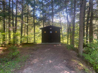
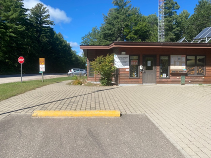
The entrance you need to go to is called “Sand Lake Access Point.” You will hit dirt road well before the access point, and it will continue throughout the park, just a heads up! You will need to stop in and register (have your license plate #), and it should cost you only $18 for the day. Military can get in free Monday-Friday. There are washrooms at the back of the building and you can buy souvenirs here like signs, patches, maps, etc.
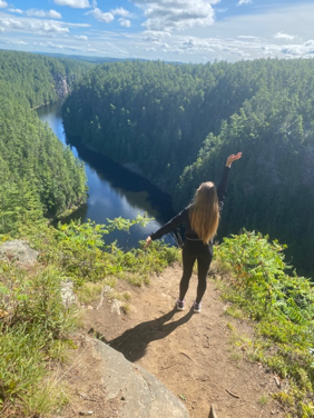
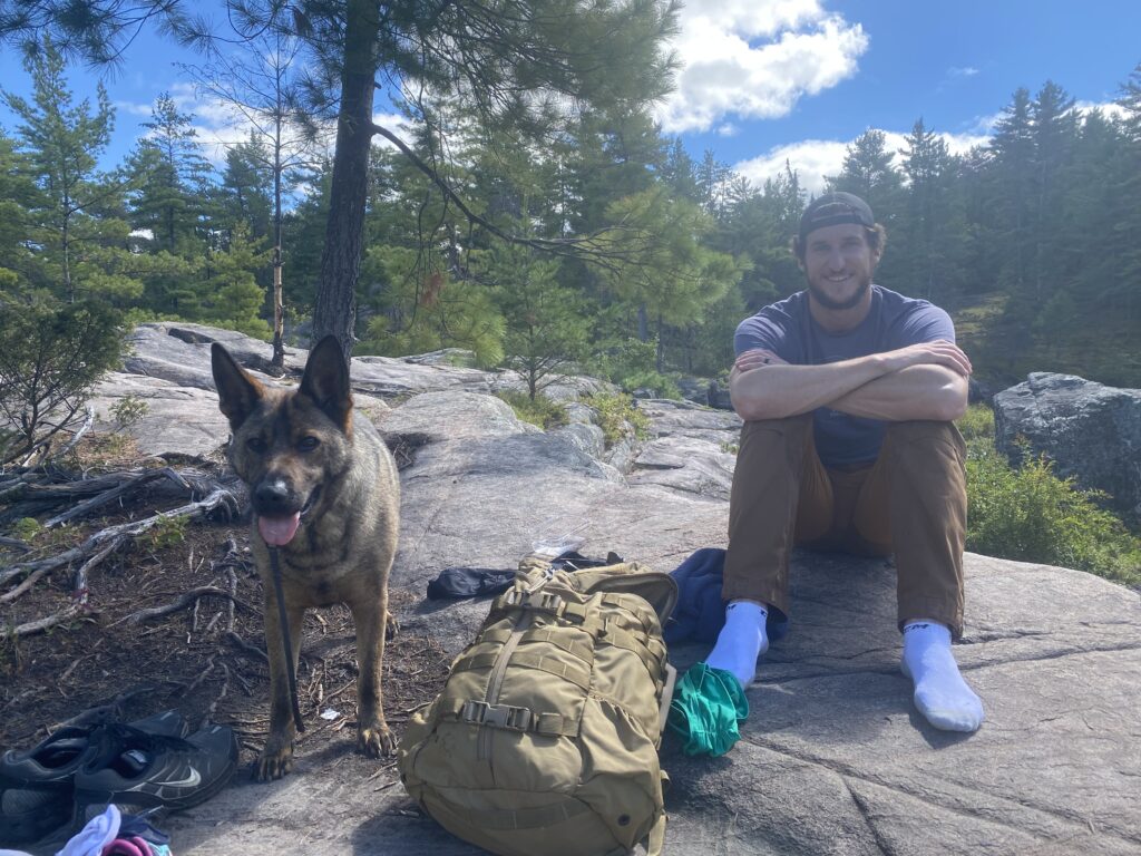
About 12 minutes from the access point, you will see the “Barron Canyon Trail” entrance. There is a lot of parking and outhouses. It is a very short 1.5km loop hike, but it is quite steep. You can read more about the trail on Algonquin Park’s website. Please note that the lookout is an unfenced cliff, so be CAREFUL. We kept our dog on a very tight leash! There are several beautiful lookout spots, and a cute “visitor’s log” on the way down. We saw some names from Denmark, Ukraine, and Whitehorse.

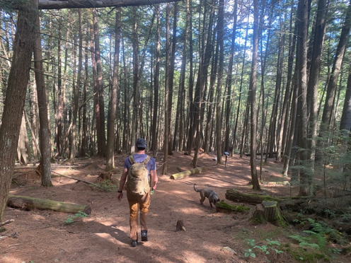
Next, we drove to the High Falls Cheater Trail. It was hard to get accurate directions to this trail, but the best way to remember is it is about 250m from the “Brigham Lake Access Point” and there will be a sign that says “High Falls Cheater Trail” with an arrow (pictured below). Here are google maps directions to a pin I made that should be pretty accurate.
Now, when you search this hike, you will find many different descriptions of the length. My husband recorded the time and distance on his fancy watch and we got 3.5km and it took us 50 minutes each way at a fast pace. There is little to no elevation, so it’s an easy walk… Until the very end. You will reach a very rocky entrance to the falls, so good shoes is a must.
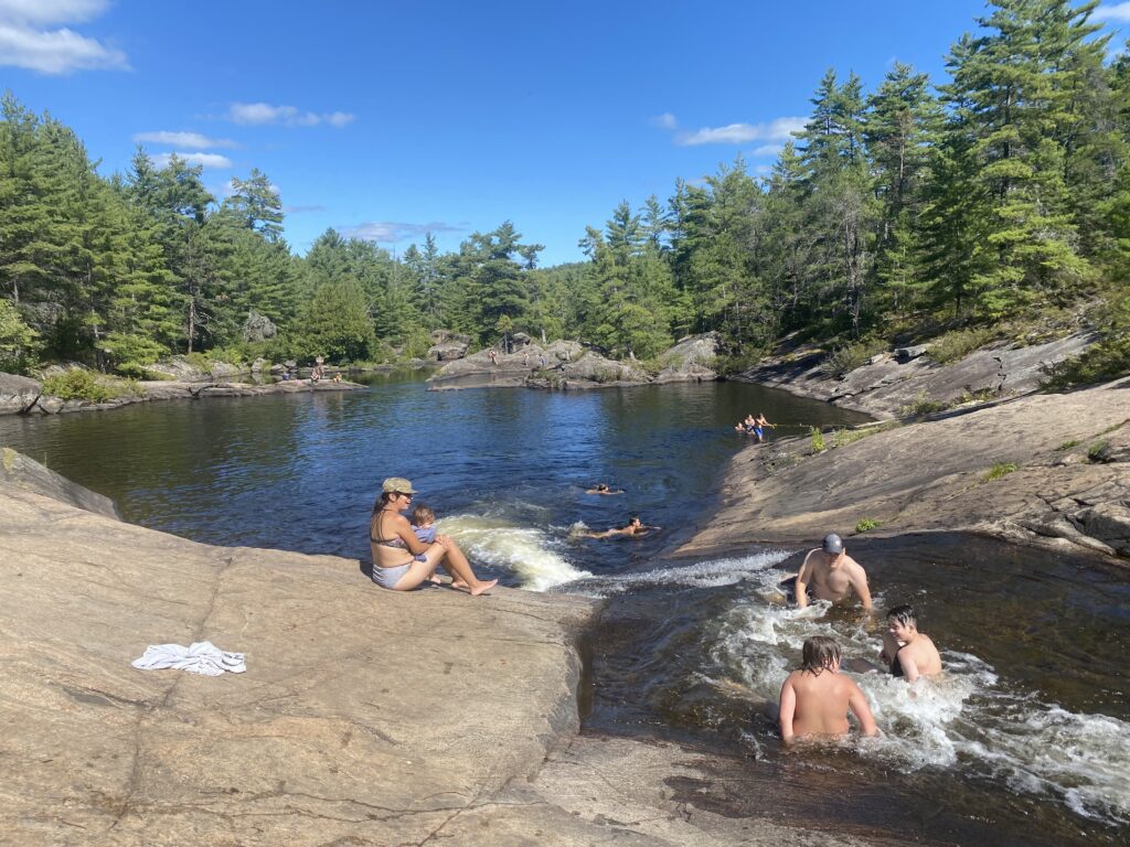
The views are absolutely stunning, but I will warn you that the falls may seem a bit “underwhelming” when you arrive. The attraction is a natural waterslide, not the most breathtaking waterfall. Save that for a Niagara Falls visit!
We arrived around 12:30pm and it wasn’t too busy – maybe around 3-4 families. Around 1:30pm, more people started arriving. It was a good thing we claimed our spot early. We tanned, jumped off the cliff, went down the natural waterslide, had a small picnic, and even snuck in a beer each to sip!
The waterslide will likely have a line, but people go down pretty efficiently. When you splash into the bottom, you have to swim yourself to the side where there is a sloped rock with a rope ladder. The rocks will be slippery. Water shoes for kids would definitely be helpful.
The hardest part about it all was changing for the hike back. A 50 minute walk in wet clothing equals painful chaffing (at least for me), so I discreetly changed back into my dry clothes under a towel.
This was an incredibly fun day trip, and I would recommend it to anyone. You can get back just in time for a nice dinner. If you are travelling back to Pembroke/Petawawa, you can check out my dinner recommendations here.